I thought Lake Mead would make for an interesting image processing example.
Lake Mead is fed by snowmelt from the Rocky Mountains via the Colorado River. It’s an essential source of water for Las Vegas and many other towns in the Southwest. Due to receding water levels, there have been concerns that it could go dry within the next decade or two.
The timelapse below shows the changes from year to year, as recorded by a remote imaging satellite called Copernicus Sentinel 2.
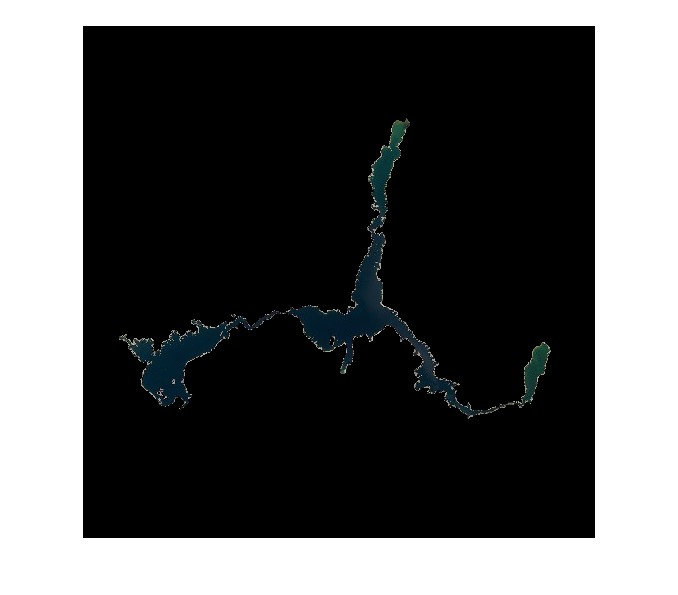
I wrote some code in Matlab to quantify the changes. This involved segmenting the lake out from the background in one of the images and then saving that sequence of steps as a function to batch process the rest of the images in my datastore. Each resulting “masked” image shows only the extent of the lake.
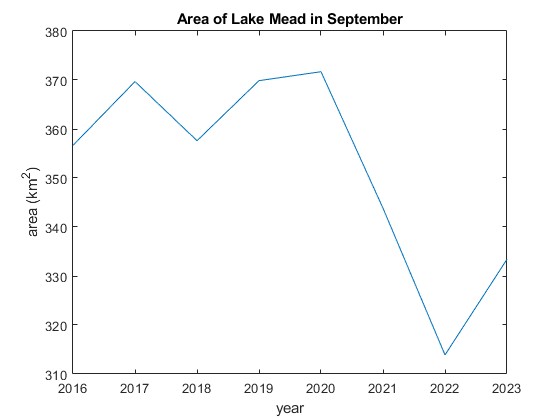
In that same iterative loop, I extracted the area and then plotted the data. As you can see, the lake receded significantly between 2020 and 2022. It’s recovering, but still has some way to go to reach the levels of the previous decade.
This is just an example of what I can do with my image processing tools. Similar techniques can be used to process images for object ID and tracking (e.g., self-driving cars), identify defects in semiconductor chips, or analyze medical images for diagnostic purposes. Any ideas?