Concerned? Not to worry, Japanese engineers know what they’re doing.
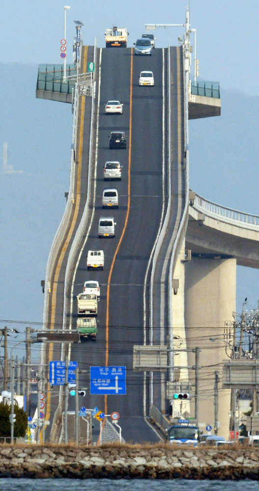
If you visit the page for the Eshima Ohashi Bridge on Trip Advisor, you’ll find review after review from travelers that describe it as rather underwhelming, disappointed that they couldn’t find the steep part in the photos. No wonder, they were expecting a 45-deg incline and it’s really only a few degrees.
Surprisingly, images like this aren’t necessarily photoshopped. What we’re seeing is perspective distortion and there’s a perfectly good explanation for it:
When you take a close-up photo with a wide-angle lens, objects in front fill the field of view, while objects in back appear smaller, buried in the surrounding scene. This is shown in the left segment of the figure below from Cambridge in Colour.
When you take a photo from a distance, you set the camera to a longer focal length (possibly switching over to a telephoto lens). The distant objects subtend a relatively narrow view angle, whether in front or in back (right segment of figure).

I took a couple photos of my calculator using a zoom lens to show this effect:
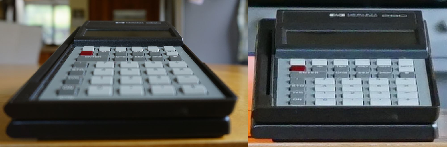
The photo on the left was taken at a close distance. The exaggerated size of the front vs. the back gives it an extended depth. This is called extension distortion.
The photo on the right was taken from a much farther distance. It was then cropped down to match the size of the close-up photo. The sidelines of the calculator don’t appear to converge off in the distance and the keys appear the same size whether they’re closer or farther from the camera.
This compressed depth effect is called compression distortion. Just like in the bridge photo, the slope looks steeper, because the depth into the page (delta x) is effectively compressed with respect to the height (delta y).
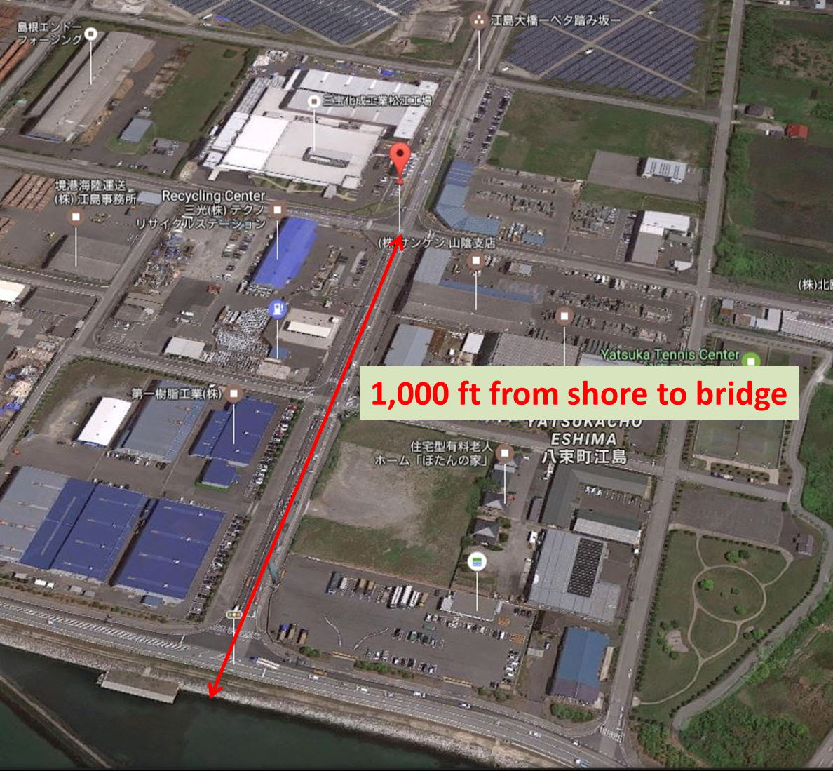
One thing you might notice about the more dramatic bridge photos is that they’re a bit pixelated. That’s because they were snapped a good distance away and cropped considerably. They typically include a shoreline (if it’s not cropped out), so we know they were taken from Lake Nakaumi, shown at the bottom of this Google Maps satellite image.
I measured a distance of just over 1,000 ft from the shore of Lake Nakaumi to the base of the bridge, so the photographer is really quite far from the bridge.
Now, that puts things in (compressed) perspective!
Leave a Reply to Donna Cancel reply
You must be logged in to post a comment.